

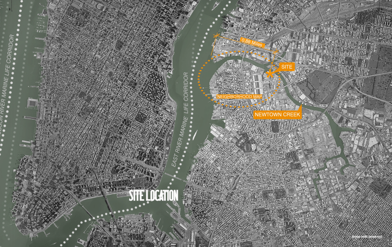
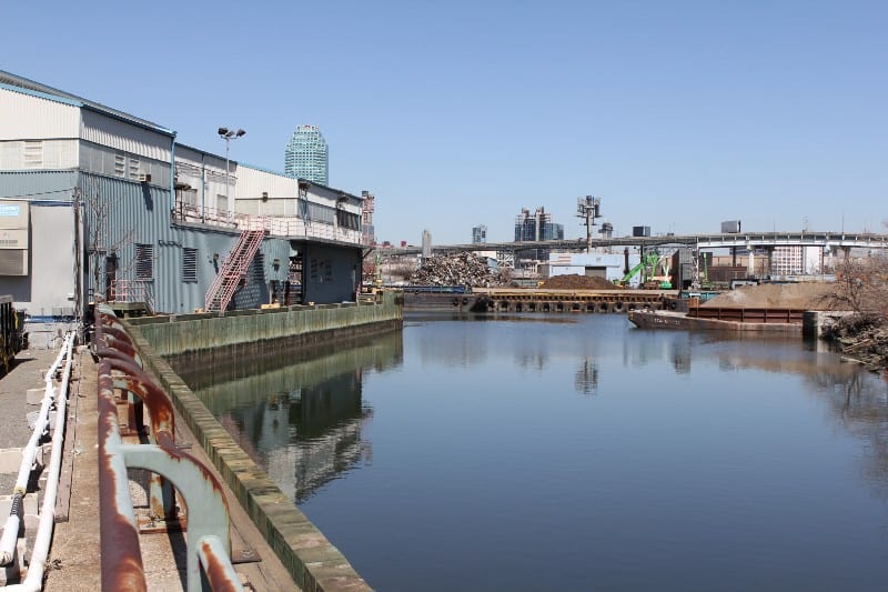
If you walk along Greenpoint Avenue toward Queens, you will eventually approach North Henry Street, which appears to be a private road for the Wastewater Treatment Plant. A little-known fact is that the street is open to the public and leads to a city-owned Newtown Creek access point.
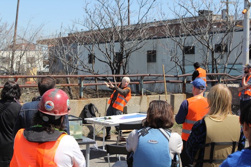
This access point — and the plans to revitalize once-thriving marshlands — were discussed last week at Sunview Luncheonette in Greenpoint. Willis Elkins, program manager at the Newtown Creek Alliance, presented his team’s “18 months of historic analysis” and forward-looking vision for the decrepit shoreline. While the plans are still in their early stages, NCA’s goal is to reintroduce an ecosystem that can also provide natural protection against rising waters.
This small area behind the Wastewater Treatment Plant was once home to the Greenpoint garbage incinerator, Grease and Compound Works (a lube manufacturer), Whale Creek, and nearby Standard Oil refineries. The full study (PDF) is available on the NCA website.
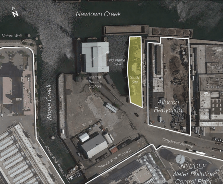
Allocco Recycling neighbors the site to the east and wants to join in the effort to upkeep the park and marshland where possible.

Elkins and his team named the area “No Name Inlet” for the time being. Given the history of pollution from the adjacent lube plant and garbage incinerator, soil samples will eventually be tested for contaminants.
In April 2015, NCA held a mapping event at the proposed site where a GPS device helped to draw the boundaries.
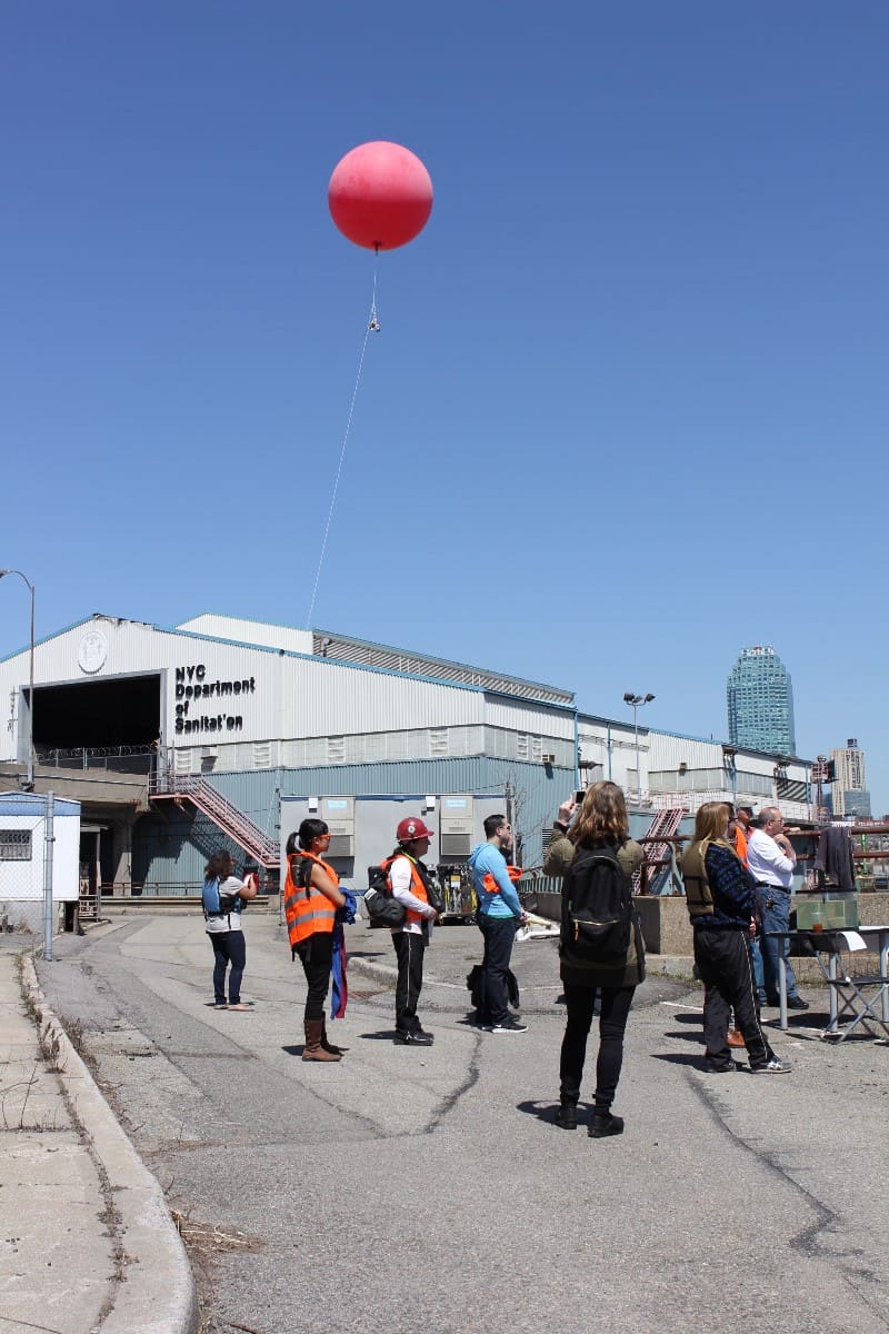
To get an aerial view, a GPS device was launched into the air, attached to a weather balloon.
The team who is working on the project includes Dr. Sarah Durand, Associate Professor of Biology at LaGuardia Community College, who leads bio-remediation efforts on the creek along the Nature Walk with planter boxes of Spartina.
Armed with a ray of hope for the otherwise murky and polluted creek, Dr. Durand and Elkins have seen preliminary success with their Living Dock project.
The floating ecosystem comprised of marine plants and ribbed mussels gives hope that a large and more permanent home for once-native wildlife may soon become reality.
“We want to revitalize this area for the natural ecosystem and for the local industry,” Elkins said.
Maybe I’m missing something, but wasn’t the marsh cemented over, not just because of the Industrial Revolution, but also to curtail yellow fever? I love the concept of a natural and native edge, however wouldn’t the combined sewer overflows have to be eliminated first?
Perhaps I’m missing something, but was not the waterfront paved over as a result of both the Industrial Revolution and efforts to contain Yellow Fever? Early coastal maps were drafted by the Depth of Health, not without reason. A natural and semi native edge would be wonderful. A recent Times article sited studies arguing some foreign species have proven to be beneficial to their new homes. However, the Combined Sewer Overflows pose a concern. Is there flora that may be implemented to deter mosquitoes and serve the above purpose? Would that be sufficient? Or would a costly ‘high level sewer’ need to be first implemented, as is supposedly intended for West St? Is that really happening on West? I visited Brooklyn’s DEP to get info about the proposal and was dismissed. I wanted to look at the numbers because the average rainfall numbers used to allow for the upzones were underestimated.
Hi Aaron,
Oh dear, it appeared as though my first comment vanished, so I submitted the second. Please disregard the first one, as the second one makes more of an attempt to explain itself.
Anyway, thanks for the article.
B:
Very good points. Yes, reducing CSO input into the Creek is much needed to improve water quality conditions and allow sustained growth of salt marsh. This is a bigger issue for the tributaries (like upper Dutch Kills and English Kills) as compared to ‘No Name’ Inlet, where we spartina is already growing in the Living Dock project. In regards to mosquitoes and disease, this would not be an issue with salt water marshes along the shoreline edge. Stagnant fresh water would be a problem, and already is for areas around the Creek with poor street drainage.
@NCA keep up the good work!
(thinking.. the viruses pose concern, not the insect)